Well, that is the movie. So, what is the real story? We will tell you here.
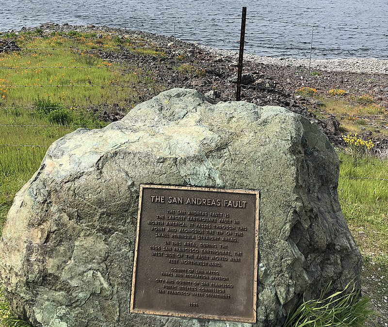
 The San Andreas Fault is the sliding boundary between the Pacific and North American Plates. It slices California in two from Cape Mendocino to the Mexican border. As is Bodega Bay, San Diego, Los Angeles, and Big Sur are on the Pacific Plate. San Francisco, Sacramento, and the Sierra Nevada are on the North American Plate.
The San Andreas Fault is what is called a transform fault. It can be best understood with this analogy: Place two slices of pizza on a table, slide them past one another where they touch along a common straight edge, where one will end up above the other. Bits of pepperoni from one side crumble across the point they touch along a common straight edge, where one will end up above the other. Bits of pepperoni from one side crumble across the point where they touch the other slice. The same thing happens with the fault, and the geology and landforms along the mighty rift are very complicated.


At Gorman in Northwest Los Angeles County, the San Andreas Fault is visible right next to the road with rocks of the Pacific Plate (gray rocks on the left side) and the North American Plate (tan rocks on the left side of the fault) and the North American Plate (the right side of the fault). There are very few places on Earth where you can see two plates in contact like this.
For anyone interested in knowing more, here are some useful links:
- Pictures of the San Andreas fault can be found here.
- Golden Gate National Recreation Area offers many interesting locations and excursions.
- Field guide to the San Andreas Fault by David Lynch, Ph.D., astronomer, and planetary scientist.

